
National Forests & Grasslands
Unified recreation app designed to improve access to National Forests with offline and online information.
Project Overview
National Forests & Grasslands is the official US Forest Service app for discovering recreation opportunities across 154 National Forests and 20 National Grasslands, a total of 193 million acres of public land. I lead the design of a unified, accessible mobile experience covering over 164,000 miles of trails and 30,000+ campgrounds, trailheads, and recreation sites, meeting Section 508 and ADA standards. The app is live on both iOS and Android with 10,000+ downloads.
Problem
Visitors planning a trip to a National Forest previously had to piece together information from scattered, inconsistent, and often outdated sources with no single source of truth for trail conditions, closures, or site details. This created real risk: outdated data on a recreation app isn’t just a UX inconvenience, it can mean a visitor arriving at a closed trailhead or missing a fire-safety alert.
The core design challenge was building a system of record backed directly by the US Forest Service’s own data. Every forest, grassland, site, and trail sourced from and continuously synced with Forest Service databases, so users always see accurate, current information rather than static or crowdsourced content. I designed the experience around this constraint: prioritizing clarity, real-time reliability, and low-friction access to safety-critical information (closures, fire alerts, amenities) alongside discovery features like search and map exploration.
Role
Lead UX Designer/Researcher
Duration
December 2023 - Present
Downloads
25.8k+
Platforms
iOS and Android
Client
USDA Forest Service
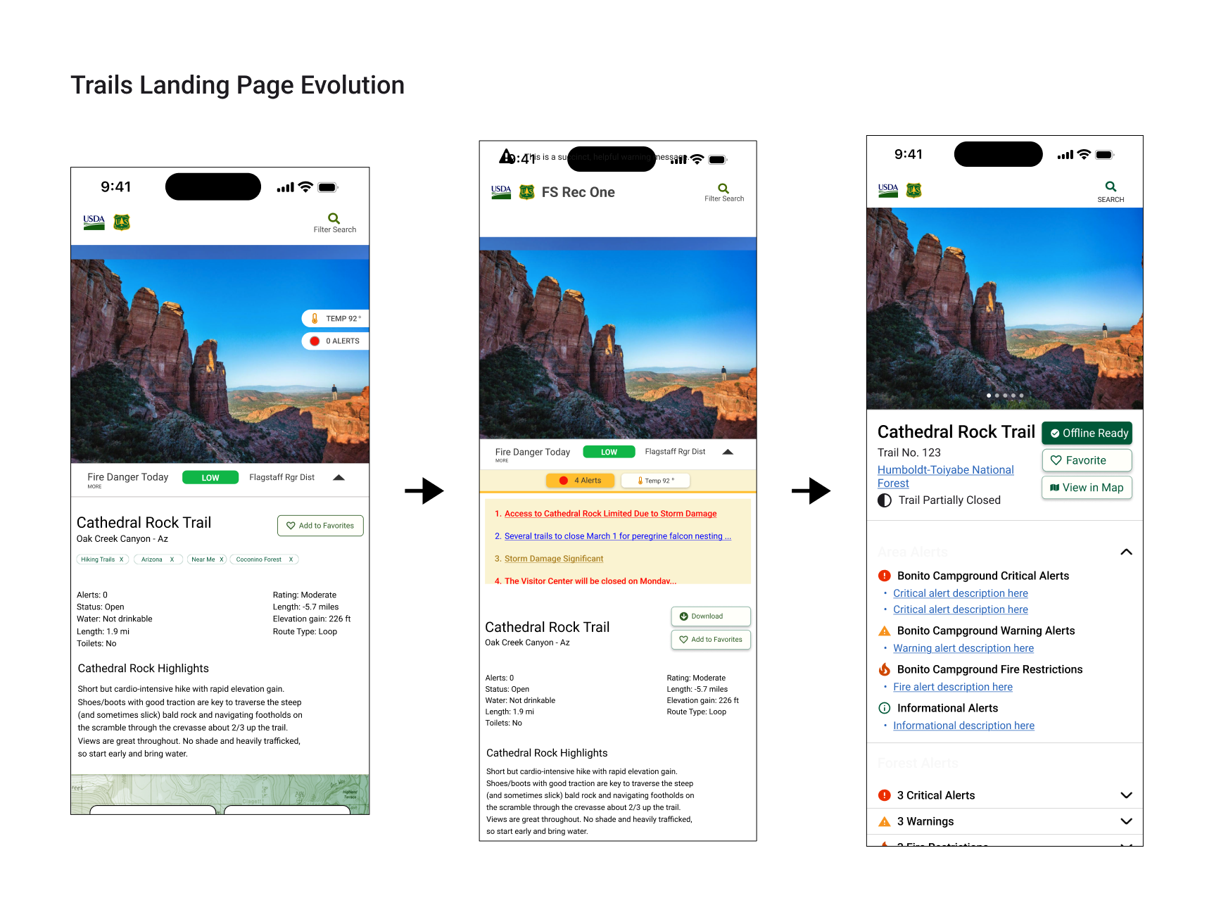
Evolution Timeline
2023 - research and concept
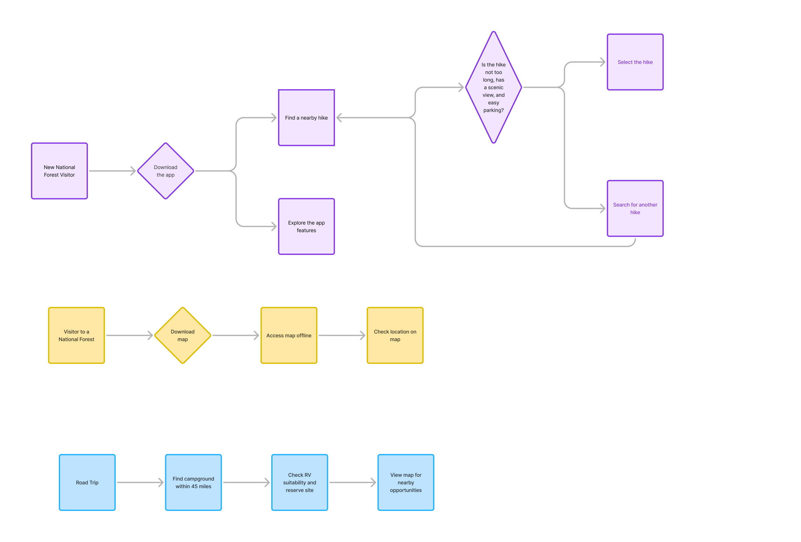
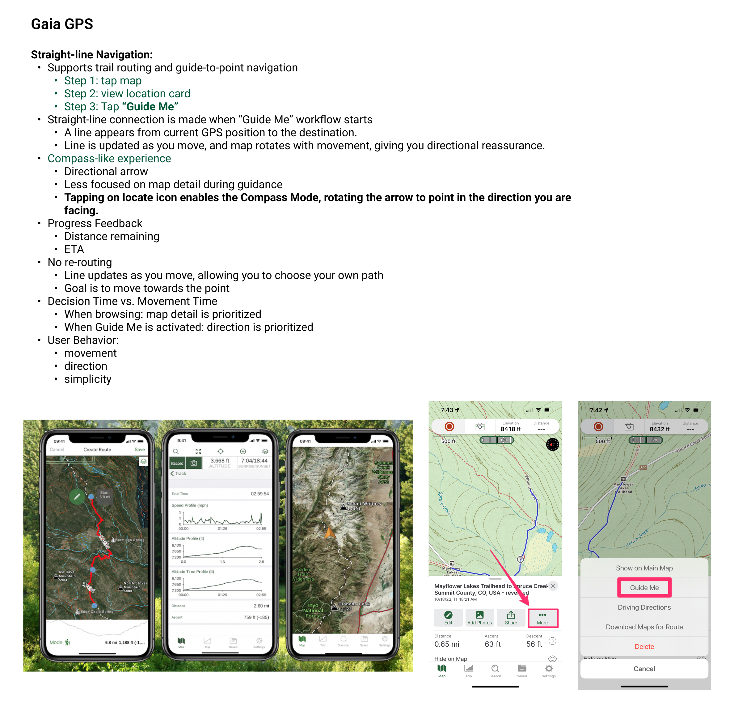
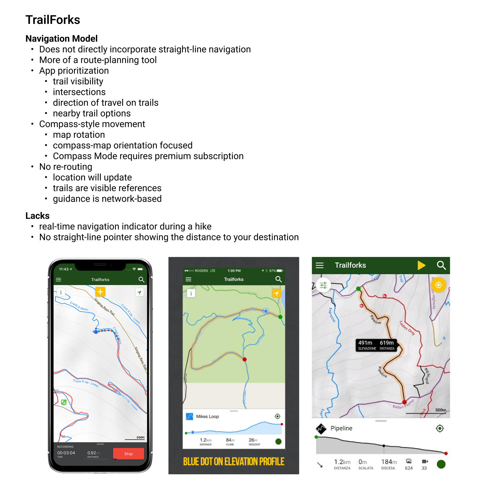
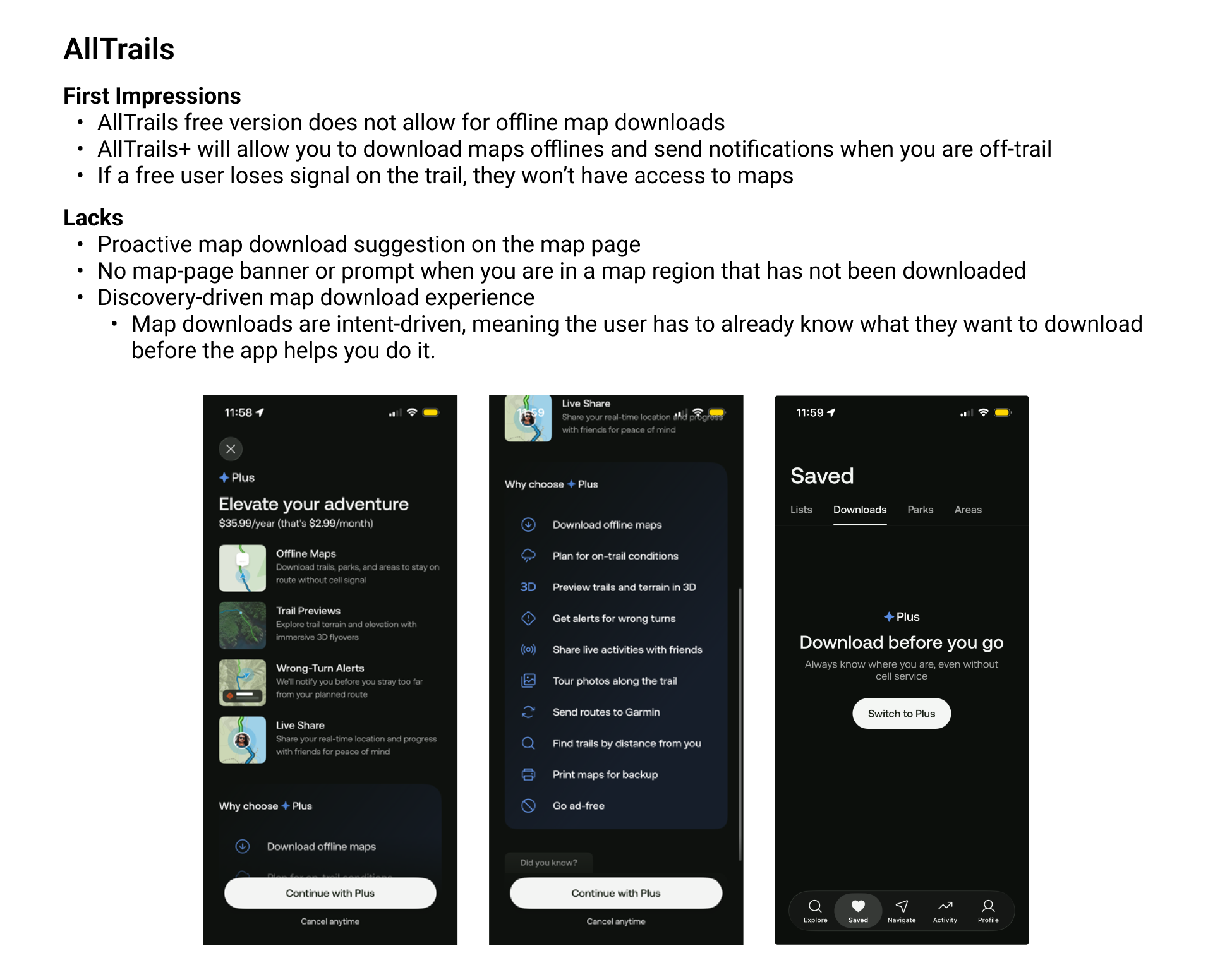
Competitive research across AllTrails, Gaia GPS, TrailForks, and moderated testing, mapping offline UX patterns, map-download flows, and GPS-triggered content before any Forest Service screens existed. Established the design principles the rest of the project was built on.
2024 & 2025 - Design validation and stakeholder feedback
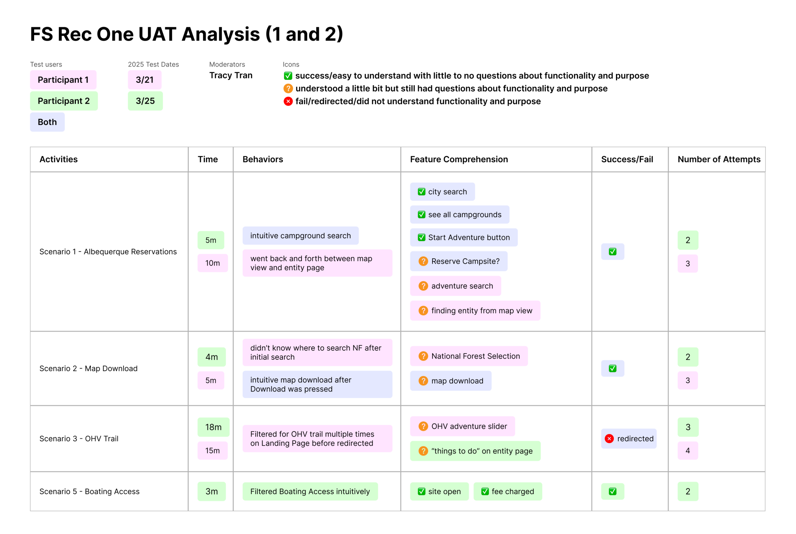
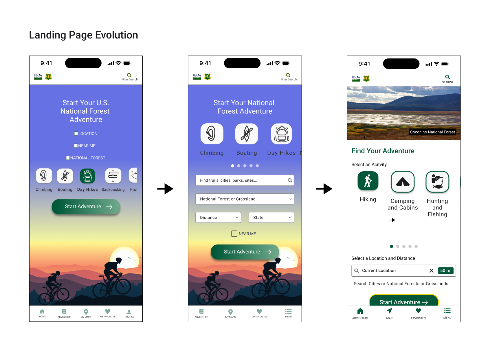
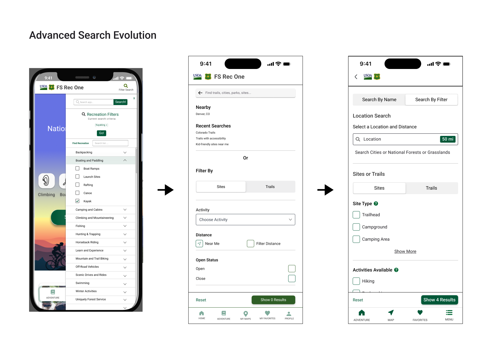
The bulk of the design work. Moving from concept to a validated, build-ready system. Usability testing rounds refined navigation structure and search behavior; findings were presented back to Forest Service stakeholders and cross-functional teams (dev, product, 508 compliance) to align on trade-offs before build. This is the stage where design decisions stopped being assumptions and became evidence-backed accessibility patterns, information hierarchy, and map interaction models were all validated against real user behavior, not just design intuition.
2026 Launch
Shipped content includes both light mode and dark mode; settings available in our menu page. Users can easily access our activity planning capabilities, filter their search in detail, and view their favorite sites and trails on the map! All is done with accurate forest service data and completely free of charge. Shipped with full light and dark mode, configurable from the settings menu. Users can plan activities, apply detailed search filters, and save favorite sites and trails directly on the map. All of it is backed by accurate, continuously synced Forest Service data, at no cost to the visitor.
Key Design Decisions
Every forest, trail, and site pulls directly from Forest Service systems in real time, rather than a locally cached copy that would load faster but risk showing outdated closures or conditions. For a safety-relevant app, speed lost to accuracy.
508 and ADA testing ran alongside every design sprint, not as a final compliance pass. This meant slower iteration early, but no last-minute accessibility rework before launch, and no compromise on it after
Stakeholder alignment existed because usability testing surfaced real friction in early concepts. Rather than defend the original structure, the information hierarchy and search flow were rebuilt around what testing actually showed
Design System

Outcomes
Since launching in March 2026, the app has seen a 1,500% increase in downloads, now at 9,800+ on iOS and 16,000+ on Android. Growth this steep this fast for a government recreation app reflects real demand for a single, trustworthy source of Forest Service data, something that simply didn’t exist before.
Every release since launch has been driven by what users actually needed, not assumptions. Offline capability was prioritized directly from user feedback. Map layers were updated based on real usage patterns. Alerts were rolled out across every national forest page where timely, accurate information mattered most.
The app continues to evolve on an active roadmap, with stakeholder confidence high and continued investment in the product’s next phase.